
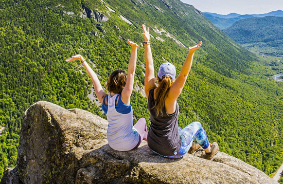
Hiking the White Mountains.
NH State Parks Launches Shuttle Service in Franconia Notch State Park to Address Hiker Parking.
This service offers a safe and legal alternative to parking on Interstate 93 for people visiting the Franconia Notch and the White Mountain National Forest. The shuttle service began Friday, August 3, 2018 and will run through Sunday October 14. The shuttle runs continuously from 8:30 AM to 8:00 PM Friday through Monday (rain or shine). The initial cost is $5 per person and only cash is accepted. For more Information, please click here.
Location: North Lincoln, Franconia Notch Distance: 2.8 miles Elevation: 2557′ Time: 1.5-2 hours Difficulty: Moderate Directions: Start at the Flume parking lot (Exit 34A off I-93) left side. Follow bike path until you find the sign for the Mount Pemi Trail on the left. Follow the blue blazed trail. Trail Map: Franconia Notch Great Views up the Franconia Ridge and down towards Lincoln. This is a ledge with beautiful views. There is also a major drop off so be very careful of your footing.
Location: Entrance to Crawford Notch Distance: .3 miles Time: 20-30 minutes Difficulty: Easy Directions: I-93N to Exit 35. Follow Route 3 towards Twin Mountain to Route 302. In Twin Mountain, at the only traffic signal, take a right onto Route 302E. Approximately 12-15 miles after Twin Mountain, you’ll enter Crawford Notch State Park. As soon as you pass the Crawford Depot station on the right and Saco Lake on the left, park in the trail-head parking lot on the right. Note: you will see the giant elephant’s head across the road from the parking lot. The trail starts across the road from the parking lot. Look for the sign. Elephant Head is another contender for “the best view for the easiest walk in the White Mountains.” It is a bit rugged, steep, and muddy, but it is only about a third of a mile each way, and leads to a sweeping view of Crawford Notch, both north and south. The trail to Elephant Head goes through a typical second-growth forest of mixed hardwoods and evergreens.
Location: Franconia Notch State Park Distance: 3-6 miles One Way or 6-12 miles Round Trip Elevation: 4760′ to 5260′ Time: 3-8 hours Directions: Parking is available at the Trailhead Parking Lot (when traveling north through Franconia Notch) or at the Lafayette Campground (when traveling south through Franconia Notch). The Falling Waters Trail is a popular trail to the summit of Little Haystack Mountain. Along the way are several waterfalls. Stairs Falls is the first waterfall seen on this trip. A few hundred feet above Stairs Falls is Swiftwater Falls; a 60-foot tall mix of cascades and small plunges. The last waterfall, and by far the main attraction of this trail, is 80-foot Cloudland Falls, a picturesque fan-type horsetail. Like the other two waterfalls, this waterfall can be seen from the trail, but the best views are afforded by sidestepping off the main trail and getting closer to the falls. Upon reaching the summit of Little Haystack Mountain (4840′), one can return to the parking lot via the Falling Waters Trail or continue along the Franconia Ridge Trail to Mount Lincoln (5089′) and to Mount Layafette (5260′). From Mt. Lafayette, one can descend to the parking lot via the Old Bridle Path.
Location: Thornton/Waterville Valley
Distance: 4.5 miles Elevation: Welch Mtn. (2605′), Dickey Mtn. (2734′)
Time: 3-4 hours
Difficulty: Moderate/Difficult
Directions: From I-93, take Exit 28 and head east toward Waterville Valley on NH 49. In 5.6 miles turn left onto Upper Mad River Road. In 0.6 miles turn right onto Morris Road, following signs for the Welch-Dickey Loop Trail. In another 0.6 mile turn right onto gravel road, which leads 50 yards to the parking area for the Welch-Dickey Loop Trail.
The trail is a loop trail. Most common route is going counterclockwise. Great views of the valley and southern white mountains. Upper portion of the trail includes ledges and rock scrambles.
Location: Kancamagus Highway Distance: 3.5 miles Elevation: 1750′ Time: 2-3.5 hours Diffculty: Moderate Directions: Dugway Road off the Kancamagus Highway. Excellent views for relatively little effort. This is a loop hike through the woods with lots of large, interesting boulders. Several ledges offer great views of the many surrounding mountains.
Location: Rumney/Plymouth Distance: 5.3 miles Time: 3-4 hours Difficulty: Easy/Moderate Directions: Off Stinson Lake Road in Ellsworth/Rumney. Most popular is an easy 2.2 mile walk to the scenic middle pond and Three Ponds shelter. From this point an easy to moderate 5.3 mile loop back to the trail head is possible via Donkey Hill Cut-off and the Kineo Trail. The Three Ponds trail head is also the eastern access of the Carr Mountain trail. An interpretive panel of the area is available in the trail head kiosk.
Location: Crawford Notch State Park Distance: 1.2 miles Elevation: 400+ feet Time: 1 hour Directions: Take Route 302 into Crawford Notch. About 3.4 miles south of height of land, you’ll turn into the well marked parking area for Ripley Falls. Start on Ethan Pond Trail, then follow Arethusa-Ripley Falls Trail to this gorgeous 100 foot waterfall. Ripley Falls is a beautiful 100-foot waterfall flowing over a smooth rock wall. The rock wall is at about a 60-degree angle, causing the rushing mountain water to maintain contact with the rock during most of its descent. There are only short, temporary periods where the water jumps away from the rock wall. Because of this, Ripley Falls, as an entire structure, is one of the steepest-angled slides in all of New England.
Location: Kancamagus Highway Distance: 4.4 miles Elevation: 2245′ Time: 3-4 hours Difficulty: Easy/Moderate Directions: 9.5 miles East of Lincoln on Kancamagus Highway. Two pretty ponds ringed by mountains and easy grades. The Greeley Ponds Trail does continue all the way to Waterville Valley, but usually hikers turn back at the second pond and retrace the same path back to Kancamagus Highway.
Location: Crawford Notch State Park Distance: 3.2 miles Elevation: 2815′ Time: 3-4 hours Difficulty: Moderate Directions: Route 302 east to the Crawford Notch Railroad Station. The trail starts behind the train station. The hike up this spur of the Willey Range is fairly steep and closed in by trees. The end of this hike rewards visitors with stunning panoramic views of Crawford Notch. Goes to the ledges above the cliffs overlooking Crawford Notch.
Discover hundreds of miles of trails and outdoor adventures at the AMC’s high mountain huts and lodges. Single/multi-day guided outdoor adventures, summer and winter skills clinics, family adventure camps, and more. A wide range of accommodations, recreation, and access to meeting facilities and special programs make AMC the ideal destination for family vacations, weekend getaways, group outings, and corporate retreats.
Location: North Conway Distance: 2.4 miles Elevation: 2369′ Time: 2-3 hours Directions: The trail head is located at the peak of Hurricane Mountain Road where there is a dirt parking lot. It is approximately 3.5 miles off Route 16 in Intervale. The trail, located in a spruce and beech forest, leads to a bare summit. The rocky summit provides views of Maine and New Hampshire’s White Mountains.
Location: North Conway Distance: 1 mile Time: 40 minutes Difficulty: Easy Directions: Parking lot is located off West Side Road, Bartlett/North Conway. Easy, relatively flat walk to beautiful rocky cascades. During the summer it is a great place for all ages to enjoy the tranquility of nature, cascading falls, and pools in the brook.
Located in Franconia Notch State Park. A well marked/traveled trail to a pristine mountain lake with great views of the Franconia Ridge. Park at Lafayette Campground parking area off I-93 south. Trail starts at the left side of the parking lot. Follow the yellow blazed Lonesome Lake Trail. After a mile, High Cannon Trail splits to the right. Stay on Lonesome Lake Trail, as it becomes steep. When you get to the top, take the Cascade Brook Trail along the south side of the lake. The trail rises almost 1,000 feet through open hardwoods most of the way. The mountain slope is steep, but a pair of switchbacks eases the grade substantially.
Location: Kancamagus Highway Distance: 3.2-6.4 miles Time: 1.5-3 hours Difficulty: Easy Directions: Four miles east of Lincoln on the Kancamagus Highway. The trail follows an abandoned railroad grade. It starts at the Pemigewasset River suspension foot bridge. The trail system includes the Lincoln Woods Trail, Pine Island Trail, East Side Trail, Osseo Trail, River View Loop, Pemigewasset Wilderness, Flume Slide Trail, Black Pond Trail, Franconia Brook Trail, the Wilderness Trail, Cedar Brook Trail, Lincoln Brook Trail, Bondcliff Trail, and many other connecting trails. The Franconia Brook Campsite is located on the East Side Trail.
Location: Kancamagus Highway – Passaconway Historic Site Distance: .5 mile interpretive trail Time: 30 minutes Directions: The trail is located behind the Russell Colbath Historic Site. Parking is also shared with the Passaconway historic site on the eastern end of the Kancamagus Highway. The Rail and River Trail is a 1/2 mile interpretive trail that takes you back in time through the history of the area. This trail is considered to be a handicapped accessible trail with its wide crushed stone path and wooden bridges.
Location: Franconia Notch State Park Distance: 8.8 miles Elevation: 5260′ Time: 7.5 hours Directions: I-93N, go past Exit 34A and exit at the “Trailhead Parking” sign after The Basin. I-93S, exit at Lafayette Place, and walk through the underpass to the other side of the highway. The most popular route to the summit of Mt. Lafayette, the OBP leaves Lafayette Place Campground in Franconia Notch. The trip starts by climbing through forest until reaching a ledge about half way to the AMC Greenleaf Hut. From here, the trail climbs the three miseries and comes out to the hut at treeline.
Location: Franconia Notch Distance: 1.5 miles loop trail Elevation: 2340′ Time: 1-1.5 hours Difficulty: Easy/Moderate Directions: From I-93 (Franconia Notch Parkway) get off on Exit 34C toward the Cannon Mountain Ski Resort and head west on NH 18. Go up roughly a half mile where you see a large parking area on your right. There will be sign for both the Bald Mtn. trail and the Artist Bluff Trail. Offers some of the best views of Cannon Mountain and Franconia Notch.
Location:Franconia Notch Distance: 2 miles Time: 1-1.5 hours Difficulty: Easy Directions: Off I93/Route 3 in Franconia Notch State Park (The Basin parking lots). The trail easily ascends along the very scenic Cascade Brook to its intersection with the Cascade Brook Trail, a segment of the Appalachian Trail.